Key takeaways
- On April 27, 2026, Public Safety Canada announced that Canada's Flood Risk Finder — Canada's first national flood hazard portal — has completed technical development.
- It is not fully live yet. Provinces and territories must opt in. Public Safety Canada will work on provincial onboarding through summer 2026.
- Once available in a jurisdiction, users enter an address and see a flood risk rating on a four-point scale (low, moderate, high, extreme) plus the type of flood expected (coastal, rainfall, riverine, or combined).
- Designed for public awareness — homeowners, renters, and small businesses checking a single address.
- It does not cover wildfire, heat, or other climate hazards. No batch screening, no exportable reports, no portfolio analysis.
What was actually announced
On April 27, 2026, The Honourable Eleanor Olszewski, Minister of Emergency Management and Community Resilience, announced that Canada's Flood Risk Finder has completed technical development.
This is a milestone, but the release is worth reading carefully. The platform exists, but it isn't yet usable for most Canadians. Flood risk management in Canada is a shared responsibility across federal, provincial, and territorial governments. Public Safety Canada will spend the summer of 2026 working with provinces and territories on opt-in. Until a jurisdiction joins, residents there will not see local flood risk information in the portal.
Put plainly: Canada has built the platform. The data layer for any specific address depends on whether your province or territory has signed on.
How the Flood Risk Finder will work
According to the federal announcement, once a province or territory participates, residents will be able to:
- Enter an address
- See a flood risk rating on a four-point scale: low, moderate, high, or extreme
- See the type of flooding expected at that location: coastal, rainfall (pluvial), riverine, or a combination
The underlying dataset — called the Federally Identified Flood Risk Areas — was developed under the Flood Hazard Identification and Mapping program, with technical contributions from Natural Resources Canada and Statistics Canada. A companion page at Canada.ca/flood-risk provides general flood-preparedness guidance.
Why this matters
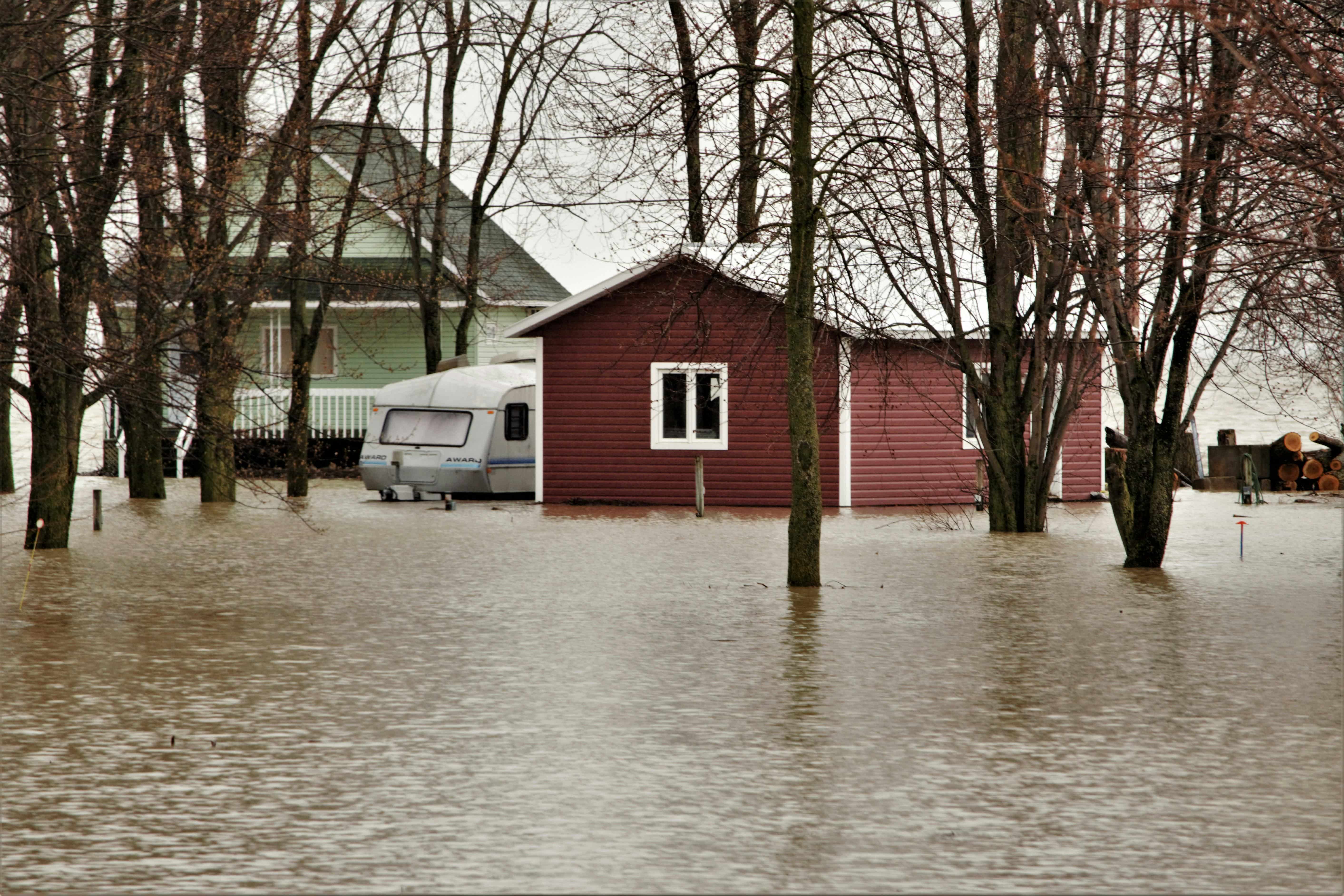
Flooding is the most common and costly natural hazard in Canada, with average annual losses exceeding $2 billion. Despite that, flood mapping has historically been fragmented across thousands of municipal, provincial, and federal products — many out of date, inconsistently rated, or hard to access.
A consistent national flood awareness tool fills a real and long-standing gap. The Insurance Bureau of Canada called the launch "an important step in helping Canadians better understand their exposure to flood risk." The Federation of Canadian Municipalities welcomed the announcement, while emphasizing that "high-quality, transparent data that reflects local conditions" is what municipalities will be looking for as provinces opt in.
For a Canadian checking on their own home, this is straightforwardly good news.
What it covers — and what it doesn't
It's worth being clear about scope, because public-awareness tools and professional risk-assessment tools answer very different questions.
What the Flood Risk Finder does well
- Single-address public awareness. A homeowner or small business owner can quickly see whether their property sits in a federally identified flood risk area.
- Consistent national scale. The same four-point rating applies coast to coast — no more comparing apples to oranges across municipal maps.
- Free and accessible. No login, no fee, no technical expertise required.
- Authoritative source. Built on federal data with NRCan and Statistics Canada input.
Where it falls short
The Flood Risk Finder is, by design, a public awareness platform. That means several things it isn't trying to do:
- Flood only. Wildfire, heat stress, and other physical climate hazards are out of scope. For Canadians in BC, Alberta, and northern Ontario — where wildfire is a growing and increasingly uninsurable risk — flood data alone doesn't tell the full story.
- Coverage depends on provincial opt-in. Until your province or territory joins, you'll see no local data in the portal.
- Single-address only. No batch upload, no API, no portfolio view. A property manager with 50 buildings or a lender with 500 mortgages cannot run them all through it.
- Coarse scoring. A four-point category scale is appropriate for public communication. It's less useful for underwriting, capital allocation, or OSFI B-15 climate risk reporting, which require more granular, defensible outputs.
- No exportable reports. Brokers, advisors, and corporate risk teams need PDF or Excel outputs for clients, credit memos, or regulators.
- No financial exposure layer. The tool tells you risk by category. It doesn't translate risk into dollars at risk, expected annual loss, or asset-weighted portfolio metrics.
These aren't criticisms — they're scope decisions. A federal awareness tool shouldn't try to be a commercial risk platform. But it does mean a substantial group of users — brokers, lenders, asset managers, and corporate risk teams — will need to look beyond it.
What this means for different audiences
For homeowners and renters
When the tool is live in your province, use it. It's free and authoritative. Pair the result with the practical mitigation steps at Canada.ca/flood-risk. If you're considering buying a property, a flood check should be part of due diligence alongside a home inspection.
While provincial opt-ins roll out through summer 2026, postal-code-level tools using NRCan flood susceptibility data can give you a directional read in the meantime — including ClimaInsight's free screening.
For mortgage and insurance brokers
The Flood Risk Finder will give your clients a credible, government-branded answer to "is my home in a flood zone?" That's helpful — but it doesn't replace the workflow you actually need:
- It's one address at a time.
- It covers only flood. Your clients in BC and the prairies care about wildfire too.
- There's no exportable client-facing report.
- It doesn't aggregate to portfolio level for small commercial clients.
The federal tool is a great first stop in client conversations. Anything beyond a single residential check needs a tool with batch entry, multi-hazard coverage, and exportable reports.
For commercial real estate and property managers
The Flood Risk Finder is not built for you. Even when fully rolled out, it won't accept a portfolio of 50, 200, or 500 properties; combine flood with wildfire and heat exposure; weight risk by asset value or NOI; or produce reports an investment committee or lender will accept.
This is the gap commercial-grade tools fill. ClimaInsight is built around exactly this workflow: address-level geocoding, batch portfolio screening, combined hazard scoring, and Excel/PDF outputs.
For banks, credit unions, insurers, and OSFI-regulated entities
If you're working toward OSFI B-15 compliance or preparing IFRS S2 climate disclosures, the Flood Risk Finder is a useful public-data reference but not a B-15 solution. B-15 expects climate risk to be embedded in your enterprise risk management framework — quantified, methodologically defensible, and integrated with your portfolio data. A four-point public-awareness rating is a starting point, not an endpoint. Most regulated entities will continue to layer commercial physical-risk data, scenario analysis (RCP / SSP pathways), and transition risk on top.
The bigger picture
Canada's Flood Risk Finder represents something larger than the platform itself: an acknowledgment by the federal government that physical climate risk is now a national-scale concern that affects ordinary Canadians' financial decisions. Five years ago, asking about flood risk before buying a home was unusual. Five years from now, it will be standard — alongside the home inspection and the mortgage approval.
The supporting tools will keep evolving. The federal portal is one important piece. Provincial flood maps, private climate analytics, and insurer-led data products will continue to play complementary roles. The most informed homeowners, brokers, and risk professionals will use a combination.
In the meantime, the practical advice is unchanged: find out the flood risk for your property, take the mitigation steps you can, and make sure your insurance reflects your real exposure.
Sources: Public Safety Canada news release, April 27, 2026; Canada.ca/flood-risk.